Built for the drive, not just the destination.
Where to sleep each night, a hike near every stop, and what’s on the road in between. Free to use, no account needed to start.
A camp for every night of the drive
QuickCamp follows the real road and lines up campgrounds close to it, so you pick tonight’s stop instead of searching a whole state.
Camps along your route
FreeState, national, Forest Service, BLM and private campgrounds near the line you drive, with Recreation.gov availability for your dates.
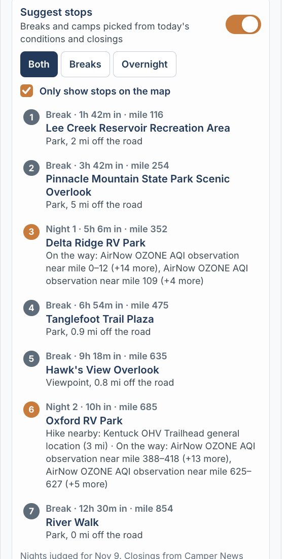
Suggest stops
Free accountBreaks and overnight camps picked by drive time, today’s conditions and closings. Closed parks are skipped and we say why.
Closings on every card
FreePark and campground closures from Camper News Now, shown right on the camp so you don’t drive to a locked gate.
Public land and backcountry sites
FreeSee BLM and Forest Service land along the way, plus thousands of official dispersed and primitive sites.
A hike near every stop
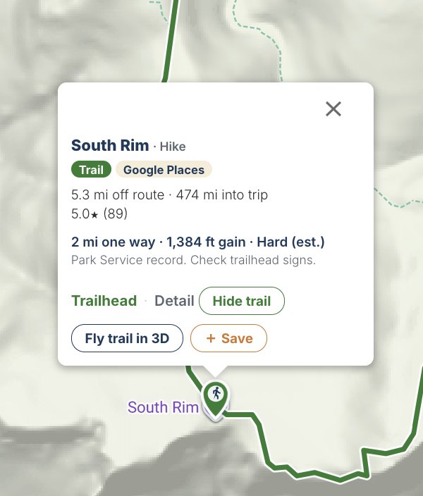
Every camp comes with trails nearby, with the numbers that matter before you lace up.
Trail details
FreeLength, climb, difficulty and how far off the road. Tap Show trail to draw it on the map.
Scout things to do
FreeViewpoints, ghost towns and landmarks near the part of the map you’re looking at.
Scout top picks
Free accountLet AI pick the best few for you. Free accounts get a few a month; Premium is unlimited.
Fly the trail in 3D
PremiumPreview the climb and the views before you commit to it.
Know the road before you drive it
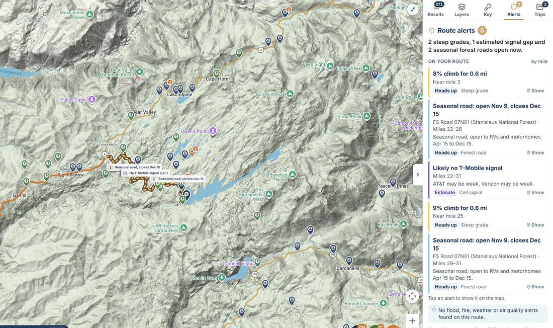
One list of what’s on your route, by mile: weather, fire, smoke, steep grades and roads your rig shouldn’t take.
Weather, flood, fire and smoke
FreeOfficial alerts from the National Weather Service, USGS and NASA, checked along your line.
Forest and BLM road warnings
FreeRoads closed to your vehicle, seasonal gates and high-clearance-only stretches.
Steep grade alerts
Free accountClimbs and descents of 7% or more, flagged by mile so you know where to gear down.
Elevation profile and towing mode
PremiumThe whole climb at a glance, tuned for trailers and big rigs.
Road cameras
PremiumLive and recent camera views from state DOTs along your route.
See where your phone goes quiet
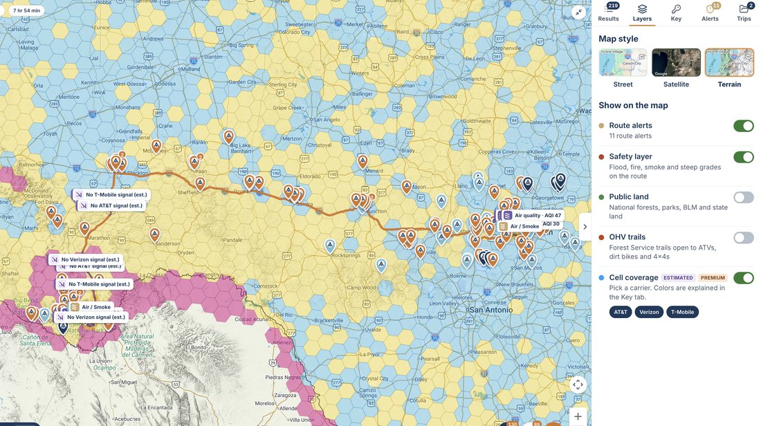
Check signal at camps and trailheads, and spot dead zones on the drive before you lose maps and messages.
Signal on camp and hike cards
FreeEstimated coverage from FCC carrier data plus reports from other QuickCamp users.
Dead zones on your route
Free accountHow many miles you may be without signal, so you can download what you need first.
Carrier coverage layer
PremiumAT&T, Verizon and T-Mobile coverage on the map.
See it before you get there
No more guessing what the turnoff or the campground looks like.
Route flyover
PremiumFly the whole drive in 3D, from start to camp.
Entrance photos
PremiumSee the campground entrance so you know the turn when you’re towing at dusk.
Campground 3D view
PremiumLook around the site and the terrain before you book.
Trips that follow you
Plan on the laptop, pick it up on your phone at the trailhead.
Save and sync trips
Free accountKeep camps, hikes and notes together on every device.
Download and share
Free accountPrintable summary, CSV, or a link for whoever rides along.
Trip news by email
Free accountClosings and alerts for your stops, 2 days before you leave. Premium adds 7 days out and every trip morning.
Start free. Upgrade when the trip calls for it.
Premium
$4.99/month
or $34.99 a year. Flyovers, elevation, road cams, coverage layer and no ads.
Go Premium| Feature | Guest | Free account | Premium |
|---|---|---|---|
| Camps, hikes and Scout along any route | |||
| Weather, fire, smoke and road warnings | |||
| Closings on camp cards | |||
| Suggest stops | |||
| Steep grade alerts and dead zones | |||
| Save, sync and download trips | |||
| Trip news emails | 2 days before | 7 days + daily | |
| Scout AI top picks | A few a month | Unlimited | |
| Route and trail flyovers | 3 a month | About 30 a month | |
| Elevation profile and towing mode | |||
| Road cameras and entrance photos | |||
| Carrier coverage layer | |||
| No ads |
Your next camp is somewhere along the way.
Paste a Google Maps link or type two places. That’s it.
Plan my route